TERRAVION IMAGERY AT MIDPLAINS AG
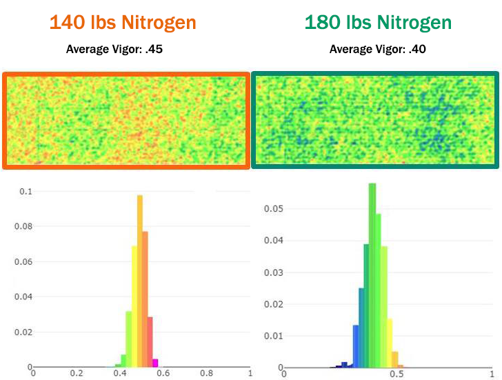
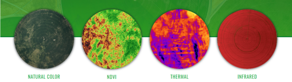
TerrAvion Midplains Ag is proud to announce that we have partnered with TerrAvion, the market leader in aerial imagery. Risk management is more than buying an insurance policy. It also means that you have the best information possible to base your decisions on. You start with your soils, your topography, and your knowledge to […]
TERRAVION IMAGERY AT MIDPLAINS AG Read More »